When Mount St. Helens erupted in 1980, it released as much energy as 25,000 atomic bombs.
The disastrous explosion devastated the immediate area. Over 230 square miles of land felt the effects, and 57 people died.
Forty-three years later, this event remains one of U.S. history’s most drastic natural disasters. But the affected land continues to heal, and you can see the progress for yourself.
Let’s check it out!
About Mount St. Helens National Volcanic Monument
Mount St. Helens erupted early on Sunday, May 18, 1980. An earthquake sheared off part of the mountain’s face, causing a massive avalanche. The movement of so much rock and ice changed the pressure within the volcano. As the gases inside shifted, they caused a giant eruption lasting nine hours.
The catastrophe drastically changed the land, wildlife, and vegetation in its path. The surrounding area wasn’t a dense forest anymore but a flat, colorless zone filled with ash. President Reagan worked with the U.S. Congress to transform the location into a monument in response to the disaster. The Mount St. Helens National Volcanic Monument officially opened in 1982.
This protected area is a haven for hikers, nature lovers, and general visitors. It stands to educate the public on the history of the Mount St. Helens disaster. It’s also a valuable research site. Rather than restoring the land after the eruption, we let it evolve naturally without human influence.

Where Is Mount St. Helens?
Mount St. Helens sits mid-way through the Cascade Mountains. At more than 14,000 feet, it’s the highest peak. The range runs for about 700 miles from northern California into southern Canada. They’re part of the Ring of Fire, an extended system of volcanoes formed over thousands of years.
Mount St. Helens isn’t the only volcano in the Cascades. Twelve other volcanic peaks populate this range. Before 1980, the most recent eruption was from Lassen Peak near Redding, California. Lassen experienced a series of explosions lasting five years, from 1914 to 1921. One was severe enough to destroy the surrounding areas.
What Is the Best Scenic Drive for Mount St. Helens?
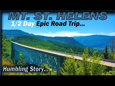
If you want to see the majesty of Mount St. Helens yourself, you’ll need to drive there. It just so happens there’s a scenic route in Washington state that takes you straight to the national monument.
SR-504, also known as the Spirit Lake Memorial Highway, is the only highway in the U.S. giving access to the former blast zone of a volcano. This 52-mile highway begins in Castle Rock, Washington, and ends at the Johnston Ridge Observatory, near the famous St. Helens crater.
There’s plenty to see and do along the Spirit Lake Memorial Highway. You can stop in the Kelso-Longview area, which boasts playgrounds, parks, and seasonal festivals. Lake Sacajawea Park is another beautiful stopping point, with scenic views and a human-made lake.
Pro Tip: Before you head to Mount St. Helens, check out these 5 Reasons to Avoid the Pacific Northwest.

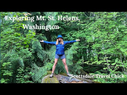
Best Hikes Near Mount St. Helens
Mount St. Helens is a unique landmark with a fascinating history. But the best way to experience this area is to see it up close. Here are a couple of great hikes near the famous volcanic mountain.
Hummocks Trail
To really get a feel for the effects of the Mount St. Helens eruption, check out Hummocks Trail in the Gifford Pinchot National Forest. Hummocks are chunks of rock and earth that fell when the mountain’s north face collapsed, and you can see them on this trail. You’ll literally be walking through history.
Hummocks Trail is a somewhat challenging loop that’s about 2.5 miles long. The route is popular, so you’re likely to encounter others. During winter, this area experiences icy conditions that make driving difficult. Bikes and pets are prohibited, so leave them at home.
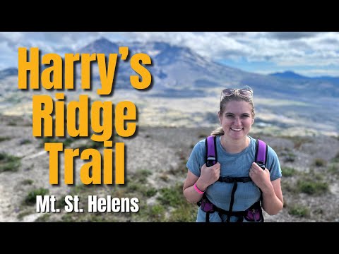
Harry’s Ridge Trail
Harry’s Ridge takes its name from Harry Randall Truman, a resident of Spirit Lake near Mount St. Helens. Truman refused to evacuate his home before the 1980 eruption and ultimately perished.
Left alone by humans since the blast, this trail is beautiful and full of life. Enjoy snowy views during the winter and flowers, berries, and green forests during the summer.
Harry’s Ridge Trail is 8.5 miles out-and-back. It’s a somewhat challenging route and takes just over four hours to complete. Harry’s Ridge is another popular area where you’ll probably encounter others. Visit this trail between June and November to avoid unfavorable weather conditions.
Pro Tip: Beware of these 7 Deadly Sins of Hiking you do not want to commit.
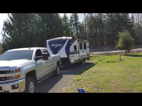
Best Camping Near Mount St. Helens
There’s plenty of camping near this famous volcano. And the best part is, no matter where you camp, it’s sure to be scenic. Here are our favorite camping options near Mount St. Helens.
Kid Valley Campground
Kid Valley Campground sits on Spirit Lake Memorial Highway, 45 minutes from the Johnston Ridge Observatory. Visitors can easily access the St. Helens area and other activities like fishing, biking, and hiking. The region is also great for hunting, skiing, and snowmobiling in winter.
Kid Valley offers full hookups, water, and sewer services. Flush toilets, trash, and showers are onsite too. Campendium users report poor cell phone reception but say the park is quiet and peaceful.
Rates for full hookup campsites start at $35 per night.

Harry Gardner Park
Harry Gardner Park sits on the Toutle River, about one hour from the Johnston Ridge Observatory. This recently-restored park was a casualty of the 1980 eruption. Visitors can enjoy hiking trails, playgrounds, fishing, and swimming.
Harry Gardner Park has partial hookups, water, and vault restrooms. Each campsite has a fire ring, picnic table, and access to a dump station and trash services.
RV campsites start at $25 per night.
Experiance the Untouched Natural Beauty
Mount St. Helens is an intimidating and awe-inspiring natural wonder. Get out there and experience it for yourself!
This volcano’s last big eruption was disastrous, but the surrounding area has healed significantly since 1980. The land will continue to thrive and grow thanks to its status as a national monument.
We’ll Help You Find the Best Free Camping in the USA
You should give it a try!
As a matter of fact, these free campsites are yours to enjoy. Every time you pay federal taxes, you’re contributing to these lands.
Become a FREE CAMPING INSIDER and join the 100,000 campers who love to score the best site!
We’ll send you the 50 Best Free Campsites in the USA (one per state). Access the list by submitting your email below: