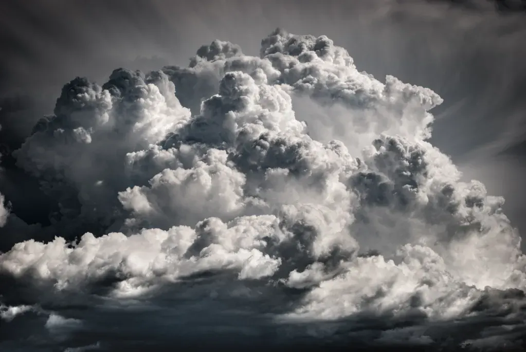
Most of us depend on technology to tell us the weather, but did you know that you can predict the forecast based on clouds?
It’s true! And it’s not that hard. You just need to know what to look for.
Today, we’re getting into what each type of cloud means for the weather ahead.
Let’s hit it!

Are Clouds a Good Way to Predict Weather?
Before your local meteorologist announced the forecast on the morning news, our ancestors used clouds to predict the weather. It’s a lost art today, but with a bit of knowledge, you can do the same thing.
While these methods don’t work for extended forecasts, they’ll help you determine whether or not to grab an umbrella on your way out the door.
Before we get into the meanings of specific varieties, we should go over the basics.
Firstly, all clouds fall into four categories. These are high-, middle-, and low-altitude, and those with vertical growth. Some varieties can occur at any elevation, and where they land in the sky is also important.
It can be hard to tell how high they are from the ground. However, a good rule of thumb is if you can see through them, they’re typically high, while lower ones are more opaque. And when the sky is covered completely, there’s a good chance you’ll see bad weather, regardless of the type.
Additionally, darker formations in blues and grays usually indicate precipitation. This is especially true when you see lots of variation within individual clouds.
Finally, stratus and cumulus forms can develop at any altitude. These are the big rain-makers. Once you can identify them at each elevation, you’ll be set.
Why you need to know what’s coming: CAUGHT ON VIDEO – RV Blown Over by Wind
7 Types of Clouds and What Weather to Expect
Now that you know the fundamentals, we’ll give you some of the most common formations to look for. Make a note of these types to help you predict the forecast.
#1 Cirrus
Wispy, feathery cirrus clouds generally form at high elevations, at least 20,000 feet above sea level. They might look hazy or hair-like in appearance. They’re made up of ice crystals and develop when warm, moist air rises.
These clouds usually mean that fair weather is ahead, particularly when they’re sparse. However, a sky full of them can indicate storms moving in within a day or two. More specifically, they can signify that a tropical disturbance or frontal system is on the way.
Watch these while they’re hanging around. If they become more concentrated, you might be in for a storm.
#2 Cumulus
Cumulus formations are those stereotypical cotton balls in the sky. They’re the ultimate cartoon depiction with rounded, fluffy tops and flat, dark bases. At some point, we’ve all pointed out these puffballs as dragons, bunny rabbits, or some other creature.
For the most part, they stick around at relatively low altitudes. When these clouds are well-spaced, they’re a sign of good weather. However, they can produce heavy precipitation when they’re huge and have many heads.
They’re related to cumulonimbus, the big rain-makers we’ll talk about ahead.
Another reason to know what weather is coming: Ford Truck Rescues Camper in Flooded RV Park.
#3 Stratus
Stratus formations hang low in the sky and often become mist or fog. Uniform and gray, these specimens often make it hard to tell what’s happening in the atmosphere above. They usually develop at night and burn off in the morning sun. But that’s not always the case.
Sometimes, the conditions prior to the appearance of stratus clouds can predict foul weather. If you notice high-altitude clouds moving in over hours or days, followed by dense fog, there might be storms on the horizon.
While these forms can produce a light drizzle on their own, don’t expect a downpour.
#4 Nimbostratus
When stratus formations become incredibly dense, they can become nimbostratus clouds, which deliver heavy rain or snow. That said, they’re usually incapable of producing lightning.
Nimbostratus is one of only two types that create precipitation. They emerge when a warm front moves over cold air. They can hang around for days at a time in slow-moving systems. In fact, these enormous storms often develop over several days.

#5 Cumulonimbus
The second type of cloud that produces significant wet weather is cumulonimbus. You can recognize them by their staggering height, stretching into multiple layers of elevation. They may extend as high as 60,000 feet. Additionally, they’re often shaped like an anvil, with flat tops.
These are usually standard cumulus formations that’ve grown exponentially. This is where vertical growth comes into play. As warm, humid air rises, it concentrates as these monstrosities. When the dam finally breaks, you’ll get lots of heavy rainfall in a short amount of time.
Large summer thunderstorms are a result of these guys.
#6 Cirrocumulus
Much like standard cirrus clouds, cirrocumulus form very high in the sky. However, these look like mottled dots or rippling water instead of a wispy appearance.
They often appear when the weather is calm and tend to dissipate into the great blue beyond. But these clouds can be early indicators of foul weather. Keep an eye on them. Consider grabbing an umbrella if they become more dense over time or other low-hanging fluff enters the area.
#7 Stratocumulus
Low-lying stratocumulus clouds are similar to regular cumulus forms, but their altitude distinguishes them. While they have that tell-tale cotton-ball appearance, they’re typically bumpy, gray, and patchy. Although they might cover most of the sky, you should see some blue between them.
These will produce light precipitation at the very most, but you won’t get heavy rainfall from them.
Want to learn more? Read The Secret World of Weather: How to Read Signs in Every Cloud, Breeze…
Clouds Will Help You Predict the Day’s Weather
You may not be able to predict next month’s weather based on the clouds, but they can help you know what to expect in the immediate future. This isn’t just a fun party trick for your next barbecue. It can come in handy when you’re camping for extended periods or even in day-to-day life.
Take a look outside and see what’s in the sky. The more you practice, the better you’ll become!
We’ll Help You Find the Best Free Camping in the USA
You should give it a try!
As a matter of fact, these free campsites are yours to enjoy. Every time you pay federal taxes, you’re contributing to these lands.
Become a FREE CAMPING INSIDER and join the 100,000 campers who love to score the best site!
We’ll send you the 50 Best Free Campsites in the USA (one per state). Access the list by submitting your email below: