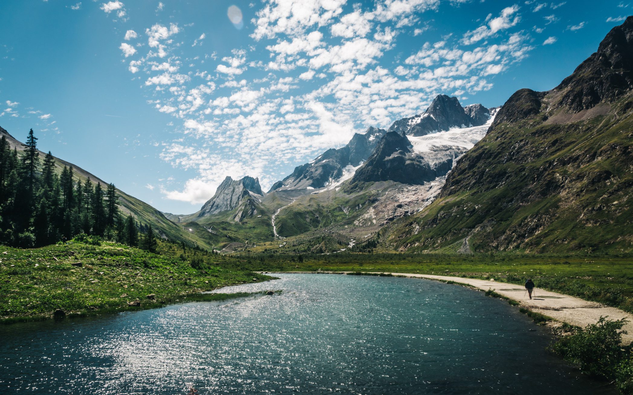
When finding ways to cool off this summer, it may be wise to avoid some of the most dangerous rivers in the USA.
Some claim more lives than all the other rivers, creeks, and streams in the country.
Where are some of the most dangerous rivers in the USA? And why are they dangerous?
Let’s jump in!
What Makes a River Dangerous?
A dangerous river can change in a few moments and hide what lies under the surface. It twists and turns across the landscape with beauty around every corner.
But doesn’t that describe all rivers? Yes, but some are more treacherous than others.
If a river begins in the mountains, snowmelt can cause rivers to become deeper than usual. If there’s a storm upriver, dropping a lot of rain in a short time, flash floods can occur in minutes.
A river’s currents can vary wildly within a few feet of the bank or even a foot or two below the surface. The width of a river will also determine the speed of the water, with narrow channels flowing faster.
Obstacles under the surface or along the banks can be natural, such as rocks and trees, or manufactured items like cars, trash, or even dams. These obstacles can cause rapids, a redirection in water flow, and even places to trap or capsize a boat.
And let’s not forget that water temperature can play a huge factor if one finds themselves in the water. 50° water temperature will cool the body much faster than 50° air temperature. The coolness of the water can cause a person to tire out faster than usual.
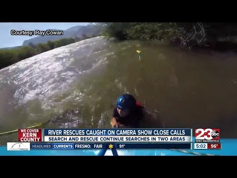
#1 Kern
About the River: The Kern River flows from the Sierra Nevada Mountains to Bakersfield, California. Snowmelt from the mountains creates headwaters and flow. It has two forks that flow through Sequoia National Park (NP) before joining together. It then flows to the mouth, 32 miles south of Isabella Dam, above Bakersfield.
The North Fork consists of many sharp rock ledges and spiked-granite protrusions. It boasts what may be the longest, linear glacially sculpted valley in the world. There are many rounded and elongated granite knobs and depressions along the riverbed.
The North Fork supports wetland habitat. The South Fork boasts a steep granite gorge that produces waterfalls and whitewater rapids.
Including both forks, the Kern River is 165 miles in length. Of its length, less than 30 are recreational or scenic. It received The National Wild and Scenic River designation in 1987.
What Makes it Dangerous: The Kern River is popular for camping, hiking, and boating. No matter the recreational choice, visitors should exercise caution. As mentioned above, much of the riverbed is granite. Even in a calm part of the river, granite is slick when wet and can cause you to lose your footing and fall.
The North Fork has a gradient of 30 feet per mile, creating Class IV and V rapids along the way. There’s a 10-foot waterfall that can kill any kayaker if it’s not hit at the right angle. Officials posted signage at the mouth of Kern Canyon warning people they could die in the river.
Considered the deadliest river in the USA, 315 deaths have occurred since 1968, 96 of those since 2000. It makes dangerous river lists across the globe and some rank it the second deadliest river in the world.
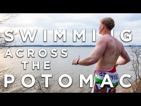
#2 Potomac
About the River: The Potomac River begins in West Virginia in the Appalachian Mountains. It flows northeast to Cumberland and then turns southwest, ending in the Chesapeake Bay.
At 405 miles in length, it’s the fourth-longest river in the eastern USA and 21st in the country. Seventy-one tributaries feed into the river, starting from its headwaters to Washington DC. The Tidal Potomac River, 117 miles in length, begins near Washington DC and ends at the Chesapeake Bay.
Its deepest point is 107 feet near Morgantown, Maryland, and is home to rapids ranging from Class II to Class V+. The river basin is also home to hundreds of plant and animal species. In the winter, bottlenose dolphins call the river home.
What Makes it Dangerous: The river many of us see when touring DC doesn’t look like it would rank among the most dangerous rivers in the US. But located west of Washington DC lies the Great Falls of the Potomac, which produce strong currents through the Potomac River Gorge. In less than one mile, the falls drop 76 feet in elevation, some 20 feet in height.
Those monitoring the river don’t suggest anyone attempt to kayak these rapids. If you think you might, they suggest strictly trying the falls in low river conditions only if you’re an expert.
As with most rivers, fallen trees and other debris can cause issues for concern. Along its length, vehicles have crashed into the river adding to the obstacles.
Various areas of the Potomac remain closed to swimmers. Besides currents, an unseen danger is a high concentration of bacteria in the water. In a heavy rainstorm, drains may not drain fast enough, causing an overflow into the river.
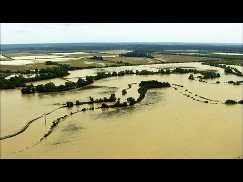
#3 Mississippi
About the River: The Mississippi River is arguably one of the most well-known rivers in the US. With a length of 2,320 miles, the Mississippi watershed drains 32 states and 2 Canadian provinces. Its basin measures over 1.1 million square miles, making it the second-largest drainage system in North America.
Approximately 250 tributaries feed into the Mississippi River, including the Ohio River and the Red River of the South.
The Mississippi River connects over 41% of the US. It has been critical in recreation, industry, agriculture, and expanding west. Before that, Native Americans relied on the river to sustain them.
Because of its sandy bottom, the river’s trajectory has changed much over time. The mouth of the river, near Baton Rouge, continues to change as silt moves with the flow. As it exits into the Gulf of Mexico, imagery shows the river does not mix into the saltwater right away. It blends in as it rounds the Florida coast and north to Georgia.
What Makes it Dangerous: The northern stretches of the Mississippi are more for recreational use than any part south of St. Louis, Missouri. But swimming in it may not be the best idea because it’s overly polluted. Agriculture and industrial runoff contribute to abnormally high numbers of pollutants.
The Mississippi has strong undercurrents and is incredibly muddy and murky. Even if someone saw you go under the water, the chances of finding you are low. The natural and manufactured obstacles are numerous along the length of the river. Flooding and the sandy bottom cause the river to change course and swallow more debris. Deadly animals such as bull sharks, alligators, and pike fish also call the river home.
Pro Tip: There are many Dangerous Creatures in the Mississippi River. Find out what lurks below the waters!
#4 Merrimack
About the River: The Merrimack River begins in Franklin, New Hampshire, where two rivers come together. It flows 117 miles before exiting Newburyport, Massachusetts, into Maine’s Gulf.
It’s the fourth largest river basin in New England, with a watershed of 5,010 square miles. Approximately 20 tributaries feed into the river. It also consists of Amoskeag Falls, Pawtucket Falls, and the Great Stone Dam.
This river was important during colonial times as it allowed for exploration inland. It also contributed to the movement of timber to shipbuilding towns like Newburyport. Along the course of the river, people took advantage of the power of the water by building textile mills.
What Makes it Dangerous: As instrumental as the river is to New Hampshire and Massachusetts, it’s dangerous too.
A massive amount of water feeds into a narrow channel causing strong currents. As still as it may seem, near Canterbury, New Hampshire, people have lost their lives due to the currents.
In 2006, the river flooded at over 58 feet and 68.4 feet in 1936.
Due to the roughness of the water where the river meets the Gulf, small boats have capsized. One report shows nine people fell into the water, and passing military ships rescued them.
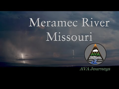
#5 Meramec
About the River: The Meramec River is one of the longest free-flowing waterways in the US. It drains almost 4,000 square miles of land into the Mississippi River.
The river meanders 218 miles from its headwaters in the Ozark Mountains to the Mississippi River near St. Louis, Missouri. From the source to the mouth, the river’s elevation drops by over 1,000 feet.
Along its journey, the river flows through limestone caverns plus a couple of state parks. It’s a favorite destination for boating, floating, fishing, and swimming. As a result, many companies offer boat tours, floats, and small craft excursions.
In the early 1700s, it was an industrial shipping route for lead. Today you’ll most likely see sand and gravel mining barges up and down the river.
What Makes it Dangerous: More than 20 deaths occur each year in this river. Within a short distance, it’s not uncommon for the riverbed to go from a depth of a couple of inches to 10 to 15 feet. Signs posted at Rockford Beach in House Springs want of debris, fast-changing currents, and sudden drop-offs.
Many people drown near the Castlewood State Park part of the river. The debris in the water can snag a swimmer or a boater and pull them under.
Many sections of the river look calm on the surface. But the currents underneath are swift and chaotic.
No flood control dams are on the river because Missouri residents voted against them due to their effect on the tributaries. In fact, a flood occurred in 2015 that shut down Interstate 55. Some believe that the flooding was a manmade problem, not because of heavy rainfall. They had found that record flooding occurred in areas that had seen development.
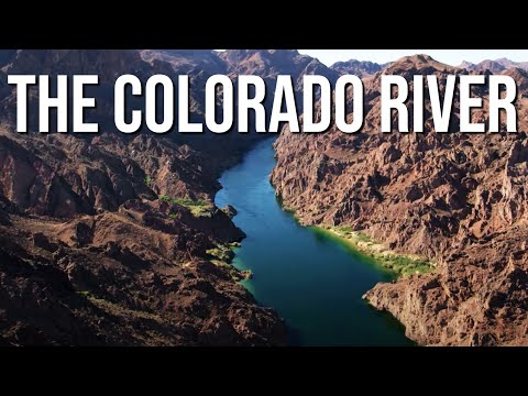
#6 Colorado
About the River: Not only is the Colorado River one of the most dangerous rivers in the US, but it’s also in danger. The river relies on melting snow from La Poudre Pass in the Rocky Mountains to flow. Climate change and human manipulation of the flow have affected how much water is in the river.
From La Poudre Pass, it flows 1,450 miles to the Gulf of California. The Colorado passes through gorges and canyons cut by the river’s force. In fact, the river passes through eleven national parks, including the most popular Grand Canyon.
Its drainage basin is approximately 246,000 square miles 25 tributaries feeding into it. Before hitting the Gulf, the watershed covers seven US states and two Mexican states.
The Colorado River provides water for 40 million people. With Colorado’s population increasing and intense droughts, the river is in danger. An environmental group called the river the most endangered river in the nation. Planning more artificial alterations could do more harm than good.
What Makes it Dangerous: The dramatic canyons and whitewater rapids make the Colorado River dangerous. There’s less regulation of rafting and boating than in previous years. As a result, it has become more deadly.
In July 2019, the river claimed 14 lives. In the Grand Canyon alone, rafting accidents claim 12 lives each year.
Although Hoover Dam is a part of the river’s flow regulation, flash floods do occur. They’ve claimed lives every year, even as recently as 2021.
Historically this river has been wild and unpredictable. It shows no signs of slowing down, even with the decrease in water levels.
#7 Red River of the South
About the River: The Red River of the South travels 1,360 miles through Texas, Oklahoma, Arkansas, and Louisiana. With a watershed of about 66,000 square miles, it’s the second-largest river basin in the southern plains.
The Red River serves as the border between Oklahoma and Texas for half its length. The river was named because of the red soil that attributes to its color.
It moves 3,450 tons of salt per day as it flows towards the Mississippi River. And from its headwaters to its mouth, the river experiences an elevation change of over 1,500 feet.
What Makes it Dangerous: The river’s murky and dark color provides very low visibility under the surface. The Red River is full of sediment as the strong currents kick up sand and dirt along its course. The strong currents also cause drastic changes to the depth of the river. With the high rate of flow, whirlpools are also a concern.
Pro Tip: If you want to float down a river, check out one of these 7 Best River Tubing Destinations in America.
Be Safer by Respecting Dangerous Rivers
You can take steps to be safe on these dangerous rivers and other bodies of water.
Wear a life jacket when entering waters you’re not familiar with. Whether on a boat or swimming, protect yourself with a life preserver. And pay attention to, and obey, posted signage.
If you find yourself in the water by accident, float with the currents and see where the river takes you. Floating uses less energy. Using more energy coupled with dropping body temperature will wear you out faster.
Respect the power of water. More drownings occur from driving a vehicle through a flood than on a boating adventure. In either situation, the power of the water currents is almost always underestimated.
As temperatures rise and the days get longer, be aware of what’s under the water’s surface as you find ways to have fun and cool off! We hope you can find safe ways to explore and adventure this summer!
We’ll Help You Find the Best Free Camping in the USA
You should give it a try!
As a matter of fact, these free campsites are yours to enjoy. Every time you pay federal taxes, you’re contributing to these lands.
Become a FREE CAMPING INSIDER and join the 100,000 campers who love to score the best site!
We’ll send you the 50 Best Free Campsites in the USA (one per state). Access the list by submitting your email below:
[…] a significant role in shaping our history and culture. Today, rivers continue to draw us in with their beauty and adventurous appeal. From whitewater rafting to fishing, there are endless ways to enjoy these natural wonders. […]
The Kern ends near Tulare, not Bakersfield. And easily 135 of the 165 miles is scenic and recreational. Not 30.